Price excl. VAT
Available as instant download
- Article number: AS14300
- Manufact./Publisher: PC Aviator
- Language: English
- Current version: 3.00
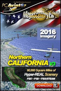
The New MegaSceneryEarth 3 - California Northern featuring unsurpassed image sharpness, scenery color and clarity, improved scenery features with accurate additional water bodies and topographical data and the latest aerial imagery.
Fly the entire state - BORDER to BORDER - of California in photoreal detail. The third largest state in the USA, California is massive at over 163,695 square miles in size and has 600 airports. You'll see everything that you see in California in real life in the scenery.
As an added bonus, we now provide all the VFR and IFR charts in digital PDF format to enable you to get the most out of your scenery. This includes 5 Sectionals, 3 Terminal Area Charts, 7 IFR enroute charts, 3 VFR Flyways Planning Charts and a 1046 page book of Instrument Approach plates, Airport Diagrams, SIDs and STARs, and an Airport Facility Directory. The charts are downloadable along with your scenery files.
Some of the cities and landmarks you'll get to enjoy as you explore California include:
- Cities: Los Angeles, San Diego, San Francisco, San Jose, Fresno, Sacramento, Oakland, Santa Ana, Anaheim, Stockton, Palm Springs
- Lakes & Water Bodies: Lake Tahoe, Salton Sea, Owens Lake, Searles Lake, 840 miles of Pacific Ocean coastline
- Mountains & Hills: Mt Whitney (14,452 ft), Sierra Nevada, Mount Williamson, White Mountain Peak, Crooks Peak, Mount Shasta, Mount Russell, Split Mountain and a total of 50 peaks above 13,500 ft.
- State Parks & National Forests: Angeles National Forest, Cleveland National Forest, Eldorado National Forest, Inyo National Forest, Klamath National Forest, Lake Tahoe Basin Management Area, Lassen National Forest, Los Padres National Forest, Mendocino National Forest, Modoc National Forest, Plumas National Forest, San Bernardino National Forest, Sequoia National Forest, Shasta-Trinity National Forest, Sierra National Forest, Six Rivers National Forest, Stanislaus National Forest, Tahoe National Forest
- Major Rivers: Sacramento River, San Joaquin River, Colorado River
- Deserts: Mojave, Colorado, Great Basin
- Islands: San Clemente, Catalina, Santa Cruz, Santa Rosa, San Miguel, Satna Barbara, San Nicholas
Set of FAA Aeronautical Charts for California:
- Sectional Charts: Klamath Falls, Las Vegas, Los Angeles, Phoenix, San Francisco
- Terminal Area Chart: Los Angeles, San Diego, San Francisco
- VFR Flyways Planning Charts: Los Angeles, San Diego, San Francisco
- Low Altitude IFR Charts: ELUS-01/ELUS-02, ELUS-03/ELUS-04, ELUS-05/ELUS-06, ELUS-07/ELUS-08, ELUS-09/ELUS-10, ELUS-11/ELUS-12
- High Altitude IFR Charts: EHUS-03/EHUS-04
- Airport Facility Directory: A fully indexed 150 page PDF booklet
- Approach Charts & Airport Diagrams: A fully indexed 1046 page PDF booklet
Please use this link for download instructions.
Microsoft Flight Simulator X (SP2 or Acceleration), FSX: Steam Edition or Prepar3D (V1-V4)
Windows 8 / 7 / Vista / XP (32 bit and 64 bit)
Download-Size: 67 GB


