Price excl. VAT
Available as instant download
- Article number: AS14303
- Manufact./Publisher: PC Aviator
- Language: English
- Current version: 3.00
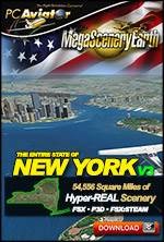
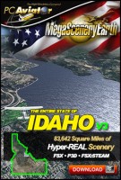
The New MegaSceneryEarth 3 - New York featuring unsurpassed image sharpness, scenery color and clarity, improved scenery features with accurate additional water bodies and topographical data and the latest aerial imagery.
Fly the entire state - BORDER to BORDER - of New York State in photoreal detail. New York State is 54,556 square miles in size and has 442 airports. You'll see everything that you see in New York in real life in the scenery. This is a massive area.
As an added bonus, we now provide all the VFR and IFR charts in digital PDF format to enable you to get the most out of your scenery. This includes TACs and Sectionals, IFR enroute charts and 457 page book of Instrument Approach plates, Airport Diagrams, SIDs and STARs. The charts are downloadable along with your scenery files.
Some of the cities and landmarks you'll get to enjoy as you explore New York State include:
- Cities: New York, Albany (Capital), Buffalo, Rochester, Syracuse
- Lakes: Ontario, Seneca, Cayuga, Oneida, Great Sacandaga, George, Chautauqua
- Mountains: Adirondacks, Mt Marcy, (5,305 Feet), Algonquin Peak, Mount Haystack, Mount Skylight, Dix Mountain, Iroquois Peak, Boundary Peak and a total of 50 mountains above 4,000 feet
- State Parks & National Forests: Dozens of them
- Major Rivers: Niagara, Allegheny, Genesee, Oswego, St Lawrence, Black, Delaware, Mohawk, Hudson
- Some Other Major Landmarks & Highlights: Niagara Falls, Lake Placid, Finger Lakes, The Adirondacks
Set of FAA Aeronautical Charts for New York:
- Sectional Charts: New York & Montreal
- Terminal Area Chart: New York
- Helicopter Route Chart: New York
- Low Altitude IFR Charts: ELUS-29/ELUS-30, ELUS-31/ELUS-32, ELUS-33/ELUS-34
- High Altitude IFR Charts: EHUS-9/EHUS-10, EHUS-11/EHUS-12
- Airport Facility Directory: A fully indexed 69 page PDF booklet
- Approach Charts & Airport Diagrams: A fully indexed 457 page PDF booklet
Please use this link for download instructions.
Microsoft Flight Simulator X (SP2 or Acceleration), FSX: Steam Edition or Prepar3D (V1-V4)
Windows 8 / 7 / Vista / XP (32 bit and 64 bit)
Download-Size: 40 GB


